Monday, June 27, 2016
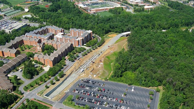
The city of Charlotte recently commissioned aerial photographs that document the progress of the 9.3 mile LYNX Blue Line Extension.
University City Partners selected 12 images for the article “Take a visual helicopter tour of our LYNX line to Uptown.”
In addition to an aerial view of the UNC Charlotte Main Station (the northern terminus of the line near Wallis Hall), there is an image that captures a four-mile stretch of the extension between the University and Old Concord Road and one that shows the J.W. Clay Boulevard Station and parking deck that are nearing completion.
Click here to read the entire University City Partners article and see more images.
Photo used with permission of the city of Charlotte.